The 1779 Tithe map of Rosemarket is held at the Archives in Haverfordwest and is the oldest known tithe map of the village. Other tithe maps of Rosemarket can be viewed online at the National Library of Wales.
Tithes were originally a tax which required one tenth of all agricultural produce to be paid annually to support the local church and clergy. After the Reformation much land passed from the Church to lay owners who inherited entitlement to receive tithes, along with the land. In some instances, a tithe barn was built to hold the tithes.
The Tithe map of Rosemarket numbers the fields of the village and identifies the tithe value and type of agricultural use for each field in a lookup table. The map is drawn on what appears to be sheep skin and is quite faded and is damaged in places. It is concerned almost entirely with the land owners of the village and land usage, but does show buildings and features which no longer exist, such as a bridge over a stream from an old road from Norton Farm, and a fulling mill. Information about the mill and old road have been covered in other articles on this website (see links at the end of this article).
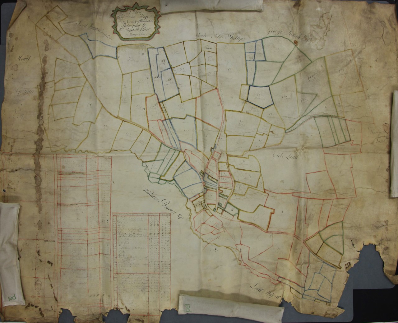
The Tithe map of Rosemarket dated 1779
.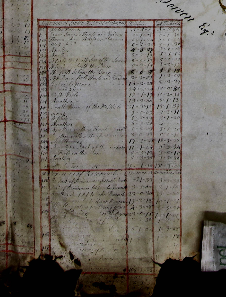
A part of the lookup table showing field numbers, Owners and tithe value
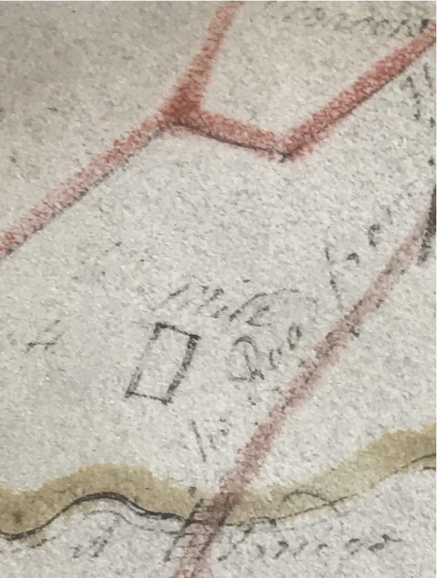
A Close-up of a section of the old Tithe map showing the old road from Norton Farm. The Road is labelled "Road from Neyland". The bridge and fulling mill are also shown.
|
Related links to Articles and information are below: Click here to read about the old Road into Rosemarket Click here to read about the Rosemarket Tucking Mill Click here to view the National Library of Wales Tithe Maps of Rosemarket |